I always notice the darkness of winter suddenly when the clocks roll back. Up until the hour change, it feels like the dark of winter is only slowly creeping up on me and then, in an instant, we lose an hour of daylight in the evenings.
It can be disheartening for someone who likes to get out into nature and make use of the daylight. Mellow hikes that go on for eight hours or more in the summer suddenly become serious endeavours in the winter, as they usually start and end by headlamp.
But the shorter days simply mean planning for shorter hikes, and Squamish is an excellent place for those. This town is pretty much surrounded by trails we can reach with only a few minutes of driving.聽
So here are some ideas for short hikes I鈥檝e been on around Squamish that I highly recommend checking out.聽

Smoke Bluffs Loop Trail
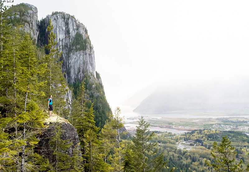
Smoke Bluffs Park is a local favourite and always worth a visit, any time of year. It鈥檚 easy to reach, well signed and offers plenty of viewpoints over Squamish, the Stawamus Chief and Howe Sound. The loop is a 2.6-kilometre return hike with approximately 191 metres of elevation gain. It should take most walkers about an hour to complete. But allow time for lingering at the viewpoints, and in winter, maybe bring a flask of hot chocolate.
Directions: At the main Squamish downtown traffic lights head onto Logger鈥檚 Lane. Follow Logger鈥檚 Lane past the Squamish Adventure Centre, across the Blind Channel and turn right at the sign for the Smoke Bluffs car park.
At the top of the car park you will see a map signboard. Stay on the trail to the left of the sign and follow all trail signs for the Smoke Bluffs Loop.
Coho Park Trail
Locals to Garibaldi Highlands and the Estates will likely know of this area, where the trails are well worth exploring. The majority of the trails are west facing, which means they have plenty of winter sun through the middle of the day. The Trestle Trail and Covenant Trail are highly recommended. Exploring the park should be around a three- to four-kilometre return hike with approximately 100 metres elevation gain. Expect a hiking time of around two hours.聽
Directions: Heading north on the Sea to Sky Highway, drive through Squamish, continue along the highway until you hit the last set of lights and turn right on Garibaldi Way. There will be a left turn shortly after on Cheakamus Way. Park at the end of the road that faces a playground. From there, walk past the playground and up the street until you hit the trailhead that leads you into Coho Park.
The Squamish Estuary
It always surprises me when I鈥檓 at the estuary and there is nobody else around except for maybe a few bird photographers. It鈥檚 a beautiful location at sunset for both the wildlife and the views of the Stawamus Chief. This is about a two- to three-kilometre return hike on flat land. At a leisurely pace, it should take just over an hour to complete. Bring some binoculars for the birds; you will likely be surprised by the sheer variety of wildlife on display.聽
Directions: Heading north on the Sea to Sky Highway, continue past downtown Squamish until you reach Industrial Way, where you will turn left. Turn right at the Queen鈥檚 Way intersection and follow Queen鈥檚 Way until it curves left and becomes Government Road. Follow Government Road past the train tracks to a small sign for The Spit on your right. Continue down the gravel route until you reach another T intersection where you will turn left. Follow the gravel road until you reach the hiking trailhead signs on your left for the estuary.聽
Brohm Lake Interpretive
Another classic Squamish destination is Brohm Lake, but many people stay near the lake and won鈥檛 venture further along the trails into the forest. Doing so is well worth the effort. There are hidden picnic tables with views of the Tantalus Range, viewpoints over the Squamish Valley and an old fire lookout perched on a rocky bluff where you can wait out any rain. The views from the fire lookout are panoramic; it鈥檚 well worth waiting out any low clouds that might be obscuring the views. The Interpretive Forest hike is a 7.5-kilometre return distance with 100 metres elevation gain. Plan for around three hours to complete it.聽
Directions: Heading north on the Sea To Sky Highway, drive through Squamish, continue along the highway, passing signs to Alice Lake, and a few minutes later, Brohm Lake will appear on your left. There is a left turn lane to the parking area, just after the section of lake that can be seen from the highway.聽

Sea to Summit Trail
The benefit of this hike through the darker months is that it is only one way. Once at the top, you can take the Sea to Sky Gondola back down to the bottom, once the gondola reopens Dec. 4. At seven kilometres long, one way, with about 850 metres of elevation gain, this is definitely one of the more strenuous hikes in this list. Nevertheless, most individuals should complete it in a hiking time of between three to five hours. Plan to be at the top before the gondola closes as a hike down in the dark of winter is not recommended. Plan to do this hike after Dec. 4.
Directions: Off the Sea to Sky Highway, turn right into the Sea to Sky Gondola parking lot. The trail begins at the far end of the parking lot and is well marked all the way to the top.
Sigurd Creek Waterfalls
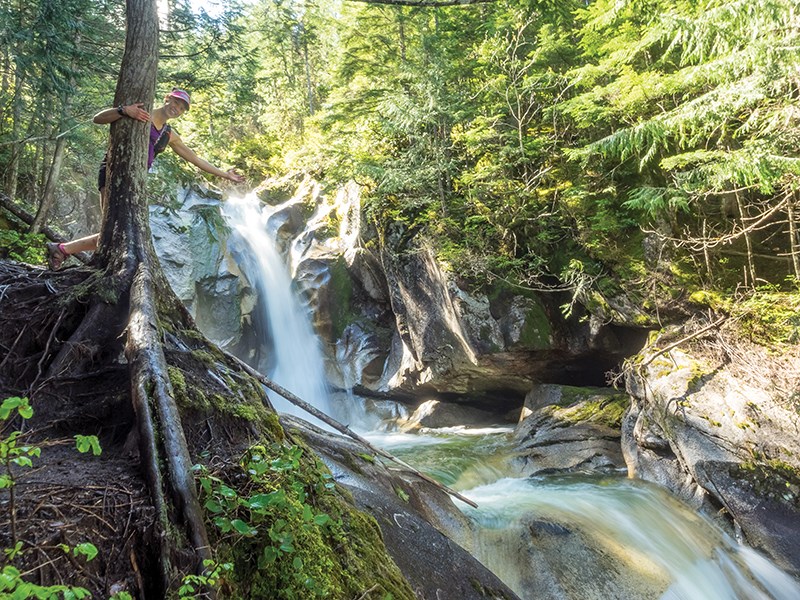
Of the hikes I鈥檝e listed here, this might be the most strenuous in winter. Be cautious. The trail is easily navigated in summer but can become indistinct in winter. Care should be taken near the edges of the waterfalls as ice can build up and become slippery. But if you are experienced with hiking in winter, this is definitely worth the effort.聽
It鈥檚 around a six-kilometre return hike with 430 metres of elevation gain. Plan to take around four hours to complete it.
Directions: Heading north on Highway 99, turn left on the Squamish Valley Road and follow it for 26.5 km. At the 23.7 km mark, watch for a large bridge on the left and an Ashlu Valley recreation sign, and turn left here over the bridge. After 500 metres, continue straight over another bridge and ignore all side roads until you reach a construction checkpoint at 1.6 km for the Ashlu hydroelectric project. Continue over two more small bridges at 2.1 km and 2.2 km respectively.
Immediately after the second bridge, the road curves sharply to the right. Park safely to the side of the road at the corner, across from an extremely rough road on the left marked with a trail sign. This rough road is the start of the trail. Continue up it on foot, following signs for the waterfalls at trail junctions.聽
So there you have it, a few suggestions for short hikes through the months of short daylight. Always remember to bring extra food, warm layers, headlamps and spare batteries for the headlamps and, like always, have fun and be safe.聽


